|
|
||
|
|
|
|
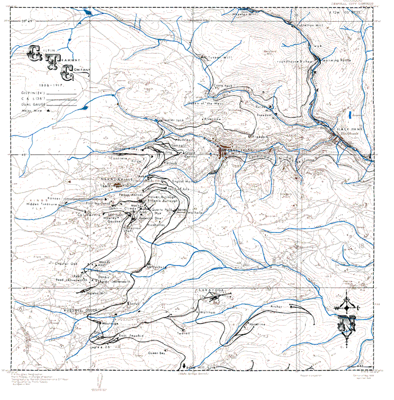
Ferrell Map of Gilpin TramwayThe below map was originally published in 1906. Mallory Hope Ferrell then added the highlighting to the map in his excellent book The Gilpin Gold Tram.
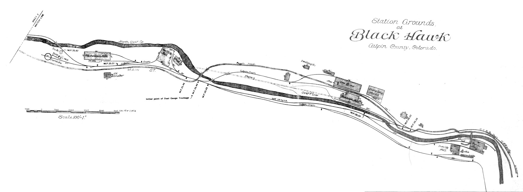
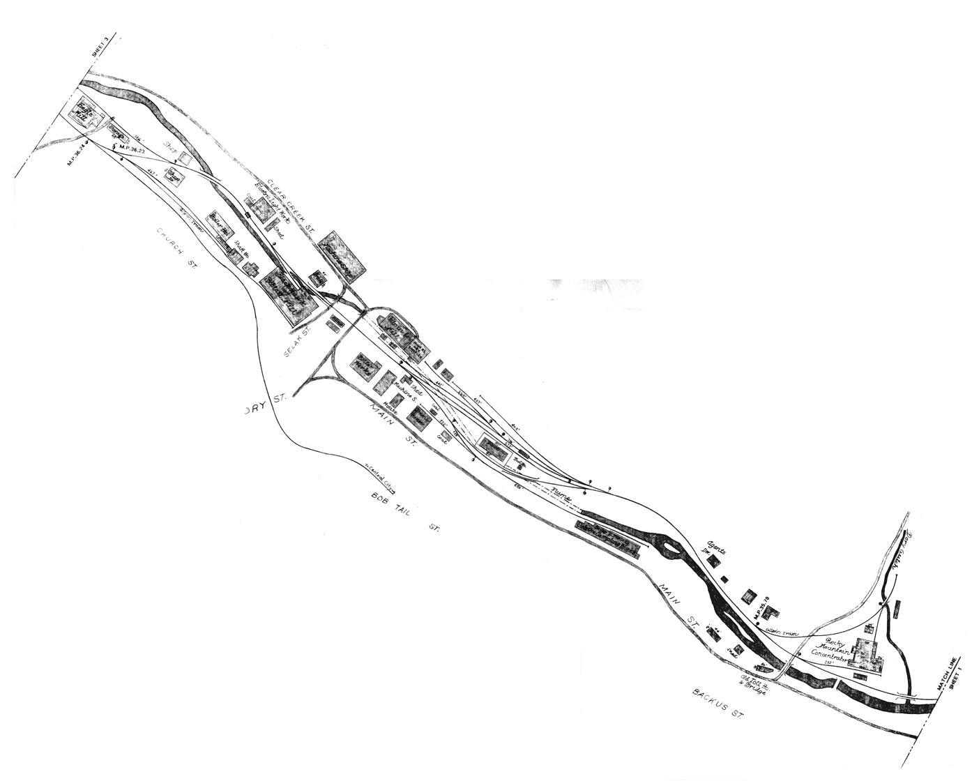
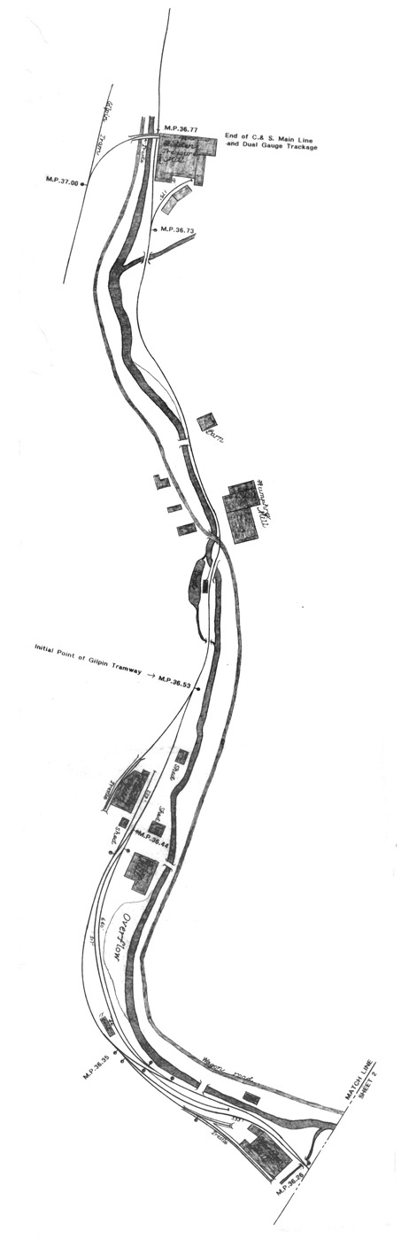
Abbott Maps of Black HawkBelow are detailed maps of the trackage through Black Hawk drawn by Dan Abbott.
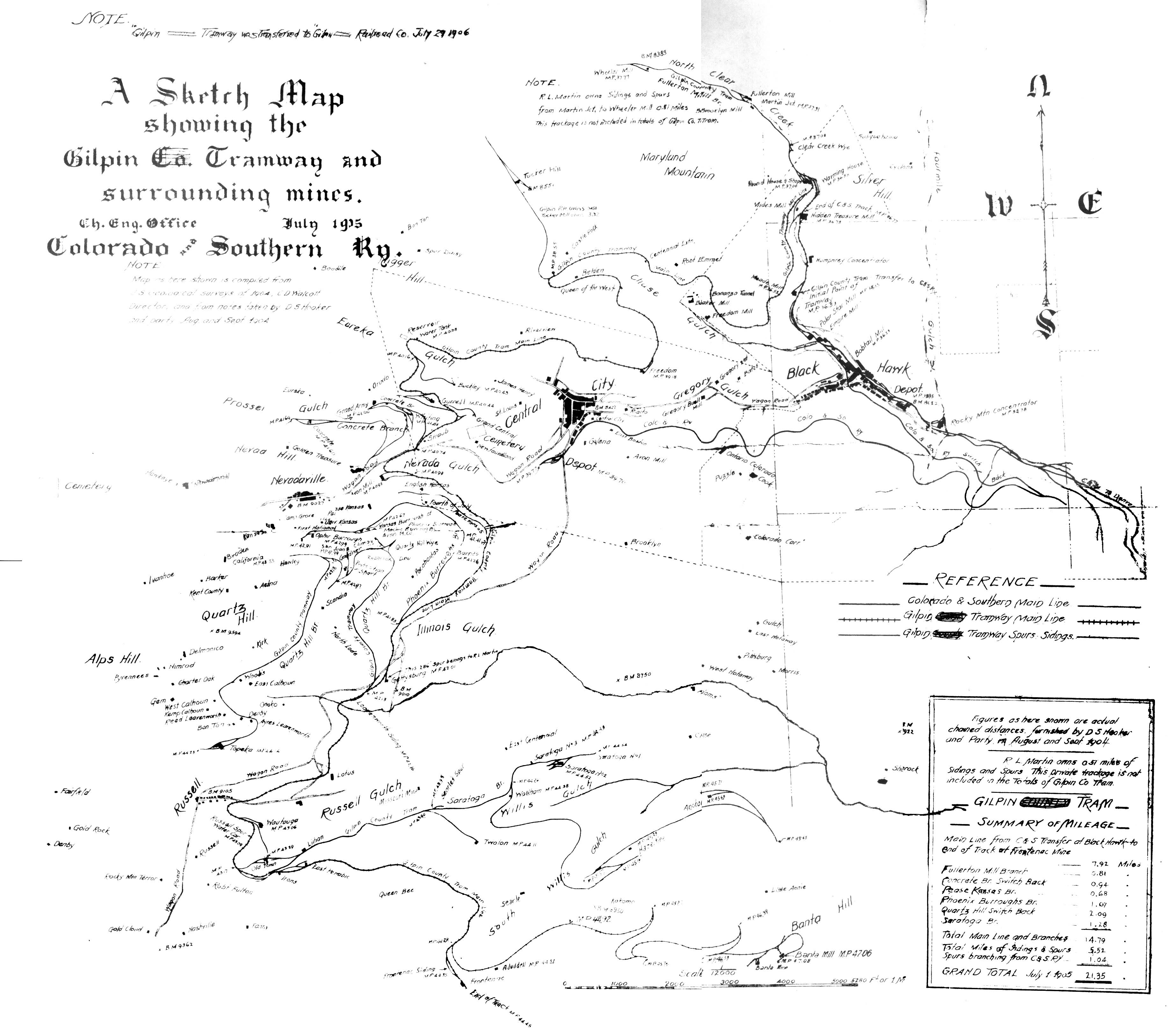
C&S Map of the Gilpin TramwayThe below map was drawn in 1905 by the engineering office of the Colorado and Southern (which bought the Gilpin in 1906). Note that although the Gilpin Tramway Company was never called the Gilpin County Tramway, the name must have been common. For the author of the map mistakenly labeled it as such and had to scratch it out.
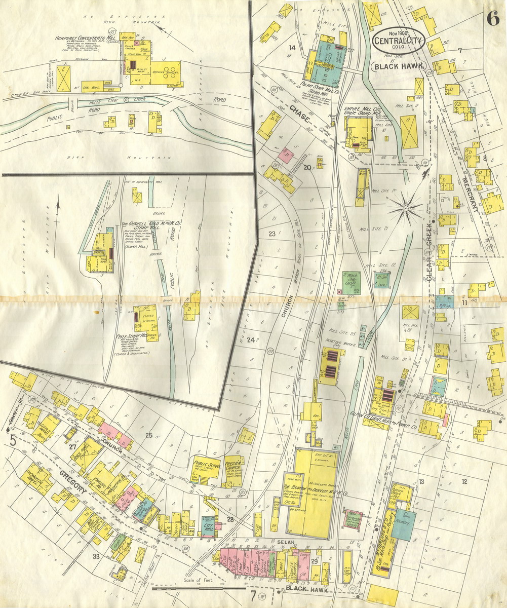
Sanborn MapsSanborn maps were maps created for insurance purposes through out the country between the 1880s and 1930s. Below is a copy of the Sanborn from November 1900 showing Black Hawk with the Bobtail (lower center) and Polar Star mills (upper center). The colors used in the map show the construction material of the buildings. Yellow are frame buildings, pink is brick, and green is stone. I believe blue is stone as well.
|
This page was last updated 01/27/07
Copyright 2007 by Mark Baldwin